

“Conkle Lake Field Report” is part of Explorer’s Guide to Boundary Country, an ever-expanding resource published by the Midway Advance online and in print. Explorer’s Guide equips you with a complete toolkit to maximize fun, discovery, and safety across all activities throughout the region.
The Call of Conkle
in Boundary Country
Explorer’s Guide by Midway Advance

The man behind Conkle Lake carries about him an aura of mystery.
Not the man behind the lake itself—that was Nature some stretch of time ago—but the name Conkle, which is also affixed to a creek, a mountain, and a provincial park (where the lake is situated).
Curiously, we know only a few facts about the fellow today.
What we do have on record is that William H. Conkle came by way of the United States, establishing a large cattle ranch near Summerland during the mineral rush days of the late nineteenth century, thanks to an account from the Summerland Review.
“William Conkle was one of Summerland’s first pioneers,” the report reads, “arriving from the United States in 1887.”
The man made a mark in the Okanagan. Within the Summerland area, local features Conkle Mountain, Conkle Mountain Park, and Little Conkle Mountain were named in the pioneer’s honour.
Conkle’s ranch, which comprised “all of Prairie Valley,” was sold off when the settler moved to Boundary Country—where William’s legacy lives on in the Rock Creek region through Conkle Lake, Conkle Creek, and Conkle Lake Provincial Park.
His name endures, but Conkle himself is shrouded in mystery because, somehow, no one has photographic documentation of the pioneer.
“Despite many years of research,” the Review says, “no photograph of Conkle has been found.”
Field Report: Lakeside
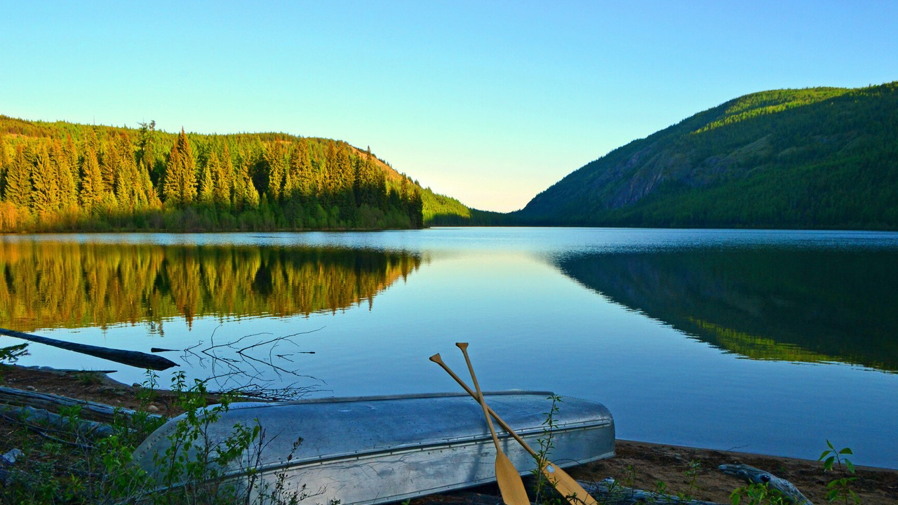
While photographs of Conkle are nowhere to be found, there is ample evidence of the lake named in his honour.
For a sampling of the water’s beauty, photographs of Conkle Lake are readily available online.
To experience Conkle Lake’s majesty in the flesh, however, is less effortless.
The drive to Conkle Lake is a task. The gravel road can at times be narrow, and cliff-sided. A 4×4 vehicle with ground clearance is recommended for comfort and safety.
It is about 16km to the lake from Highway 33, north of Westbridge, or 26km from Highway 3 (Between Bridesville and Rock Creek), according to data from BC Parks, which posits that access via Highway 3 is the “better route.”
Either way, the rough road in pays off: it’s a majestic and exclusive setting.
“This secluded park is found in the Okanagan Highland east of Osoyoos,” a BC Parks description reads, noting that the lake is “set amid a forest of mainly western larch and lodgepole pine that cover the surrounding hills.”
Popular activities at the lake include paddling, swimming, and fishing (the lake is known for rainbow trout, according to BC Parks). Hiking trails are also available. Many choose to stay overnight at the nearby campground to maximize their activity in this special area.
“Visitors have come for many years to fish as well as swim and hike to various viewpoints,” BC parks affirms.
The hidden sub-alpine lake is cold and beautiful with pine-dappled beachfront and surrounding hills of rock and larch tree. It’s a special place to bring the family for a weekend engaging in all manner of water and mountain activity.
This Explorer’s Guide Field Report is a product of the Midway Advance.
Discover more from THE MIDWAY ADVANCE
Subscribe to get the latest posts sent to your email.
